Ashdod Land
Private land at the heart of Ashdod’s North-East master plan
A privately-owned plot inside the footprint of Ashdod’s North-East expansion
Overview
This is an opportunity to acquire privately-owned land in the “Agricultural Triangle” of north-east Ashdod, one of the city’s largest strategic land reserves for future development. The Israel Land Authority is advancing a detailed plan across roughly 11,000 dunam that envisions about 90,000 new housing units and around 1,000,000 sqm of employment and commercial space, anchored by the relocation of the historic Elta/IAI plant and the preservation of the Lachish River as a central green corridor. Most of the surrounding land is state-owned, which means a small number of privately-registered plots inside the plan’s footprint are a scarce asset.
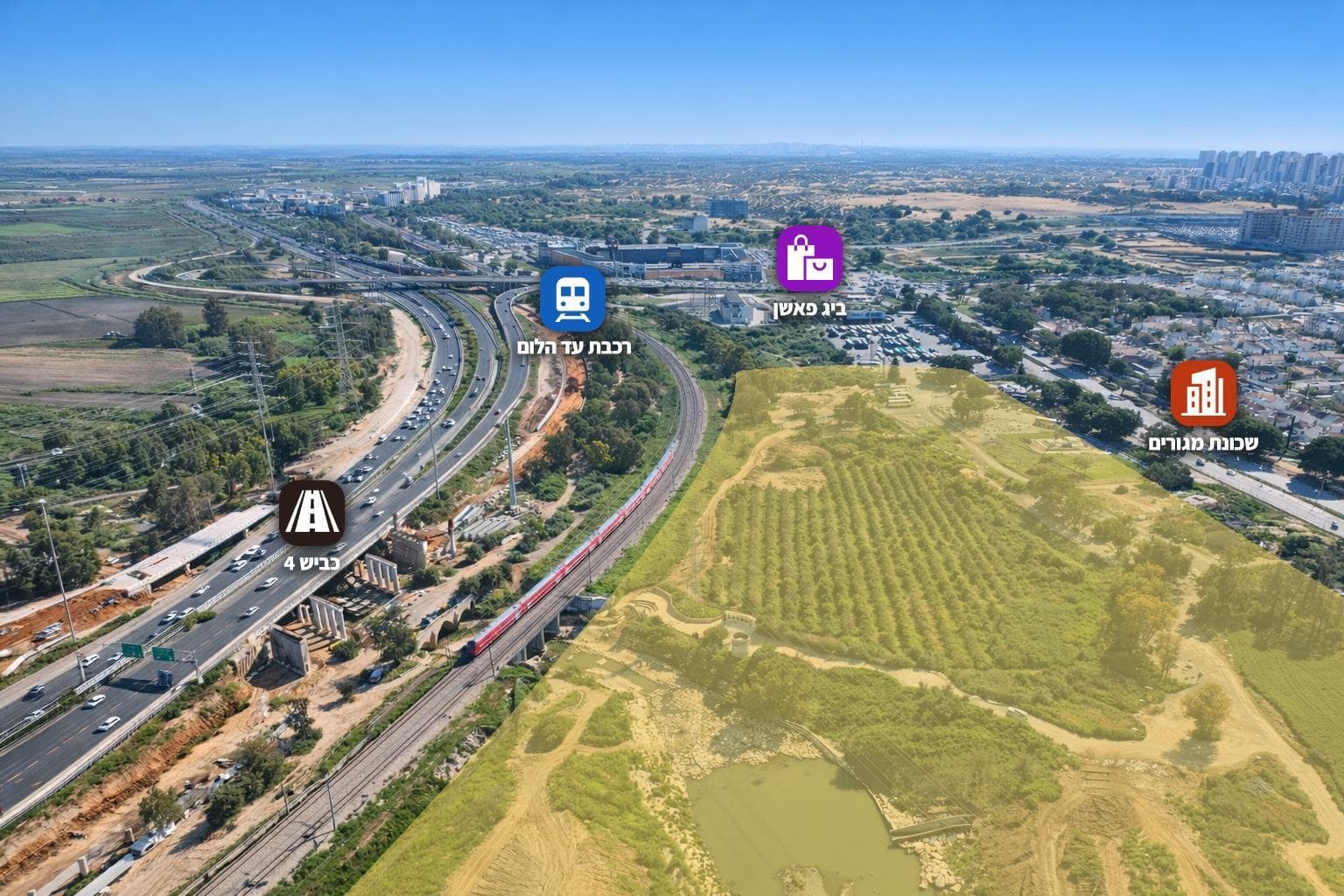
The neighborhood
Location. The plots (Block 190, Parcels 38 & 40) sit in the “Agricultural Triangle” in the north-east of Ashdod. They lie roughly 250 metres east of the Lachish River, about 850 metres from the Kiryat Halutzim neighbourhood, and around 1.1 km west of Route 4, inside the land block bounded by Route 4 to the east, Route 41 to the north, and the Moshe Sneh / Bnei Brit boulevards to the west.
The wider plan. The land falls inside the Israel Land Authority’s North-East Ashdod master plan. Spanning around 11,000 dunam, the plan envisions roughly 90,000 housing units and about 1,000,000 sqm of employment and commercial space, with new direct connections to Route 4, an integrated transport hub, and a mass-transit system linking the district to the rest of the city. The relocation of the historic Elta/IAI plant — a state-backed move estimated at around NIS 4 billion — is the trigger that frees the land for development.
Transportation. The area is anchored by the Ashdod–Ad Halom railway station near the city’s eastern entrance, with a train roughly every 30 minutes to Tel Aviv (about 35 minutes each way since the Holon line opened ). Israel Railways began a ~NIS 28 million upgrade of the Ad Halom station in early 2026, and the rebuilt Ad Halom interchange has upgraded Route 4 at the southern entrance to Ashdod, including a pedestrian bridge over the Lachish stream.
Green corridor. The plan preserves and develops the Lachish River corridor as a central green lung for the new district, also serving stormwater-management needs. Under national plan TAMA 1, the parcels carry a “flood plain” (pshat hatzafa) designation along the river, which any future building plan must address with flood-protection and runoff measures.
Figures are targets based on historical patterns, not guarantees. Availability is illustrative. Every project is subject to due diligence and discussed in detail on the call.